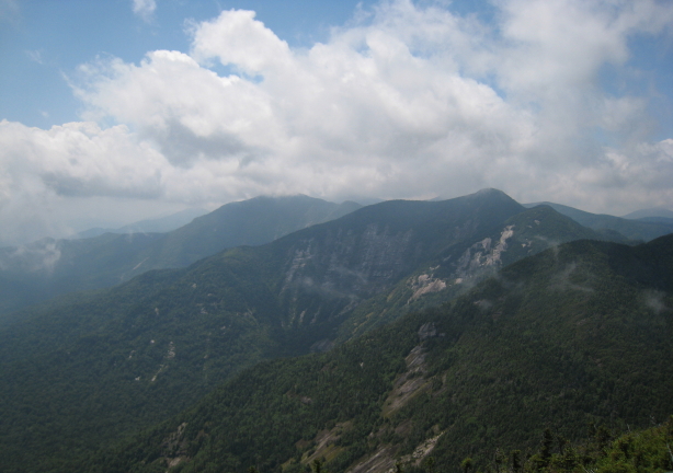
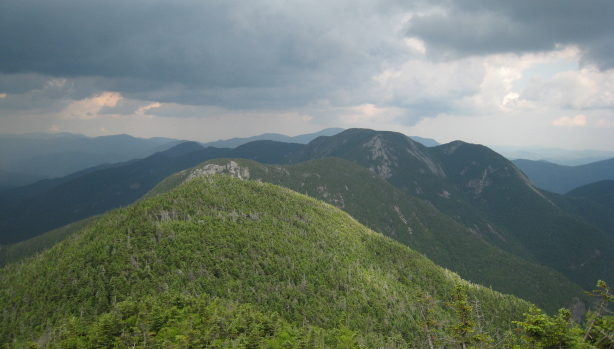
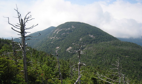
A view of the Basin Mtn. rock face from the Gothics.
Wee Hour Start
It was Wednesday, July 15 and I was staying in Burlington, Vermont for a reunion with some of my wife's family. I had brought my gear on the hope that I would be able to sneak away for the hike, and after some gracious finagling by my inlaws, had the time and a borrowed vehicle to make it there. I made it to bed just after eleven and set my alarm for three the next morning. Four hours of sleep wasn't the best preparation for such an arduous endeavor, but it was what I had and I was determined to go for it.
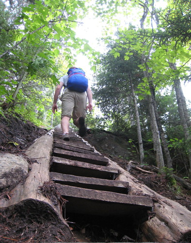
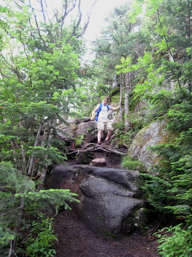
An early morning climb up Rooster Comb. The stairs were a rare luxury.
I woke up on time, took a quick shower, and hopped in the pickup. I chugged caffeine and electrolytes as I navigated the dark, wet roads passing Lake Champlain and entering the Adirondack Forest Preserve. I made it to the Rooster Comb trailhead by 6 AM. I was excited but a bit apprehensive; I hadn't done any training and would be doing some very strenuous hiking for at least the next 18 hours.
From Rooster Comb to the Wolf Jaws
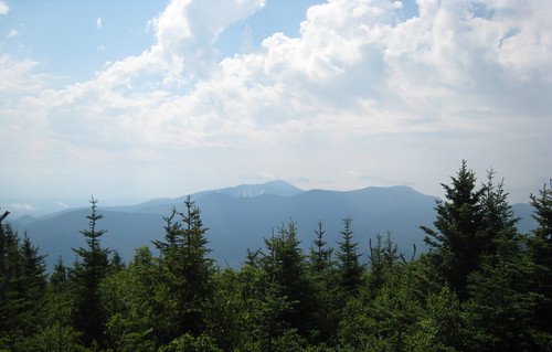
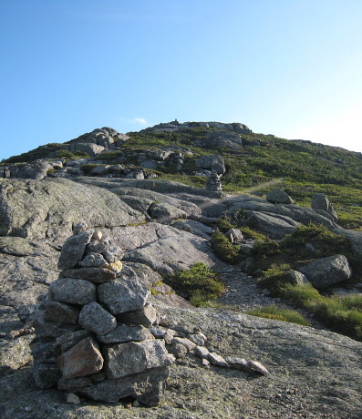
I was stiff as I came to the Rooster Comb spur trail. It was the only diversion I would take on my hike, but I was anxious for a view of the route ahead. As I reached the summit I grabbed my first snack and it started to drizzle. It was a great view and the wide sky revealed the mixture of rain and sun I could expect for the rest of the morning. The trail hadn't been too bad, but that would soon change.
The first view of the day, from Rooster Comb.
Leaving the spur, I passed over Hedgehog without even noticing and headed towards the Wolf Jaw peaks. I began to encounter extremely steep sections of the trail, climbing and descending them in between openings in the trees and peeks at the beautiful range. In reports on the traverse there had been complaints about the false summits of many of the mountains - something about them being a psychological drain. I loved them. They frequently offered views that rivaled those of the actual tops and would provide at least a small section of flat trail. The rest of the trail was becoming more and more ridiculous. Occasional scrambling on all fours now became the rule, as I grabbed stumps, tree branches and whatever else I could use to claw my way up and down the wet rocky slopes. Baggage check surcharges had led me to leave my fixed-length trekking poles at home and I didn't miss them. They would have spent most of their time strapped to my pack.

Rock damage caused by either crampons or trekking poles.
Another reason I came to be grateful to have left my poles at home was increasing damage I saw to the trail's exposed rock slabs that had been done by either winter crampon use or the poles' carbide tips. Given the pattern of the damage - down the center of navigable lines rather than their side - I imagine that most of the damage was done by crampons. Even so, I wondered how much may have also been done someone's poles. In any case, the ugly sight made me more conscious of my pole use. I've never used crampons, but I also pondered how to minimize their impact should I ever have occasion to in the future.
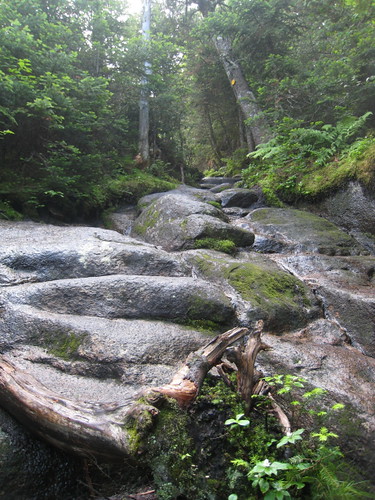
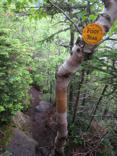
Steep, wet "trail" typical of that along the traverse.
I stopped for lunch at a windy overlook on the summit of Upper Wolf Jaw. The sun was now bright, but thick clouds blew over me and across the peak. It was noon and I had come seven and a half miles, marking about half the distance and altitude gain I would cover before reaching the summit of Marcy.
Armstrong to Basin: the Spectacular Inner Range
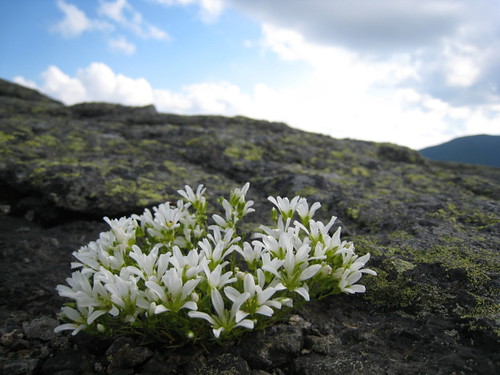
Armstrong was the first peak where I would enter the treeless "alpine zone" and I met a large group of about 15 on the top. Its summit was long and covered in a large slab of rock. I took joy in jogging over it, soaking up the beauty all around me. This was atypical of the progress I would make through this section of the trek. Each of these peaks were separated by sharp losses and gains in elevation. I felt as though I was making more of vertical journey than a horizontal one, but the payoffs here would be well worth it.

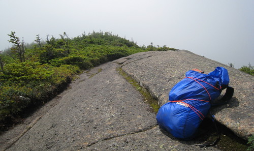
My pack on the broad summit of Armstrong. Too big for my minimal gear, I did my best to compress its load.
I came to a smaller group resting at the top of the Gothics. The descent from this peak was my favorite section of the entire hike. It was a long, steep rock face, with yellow trail blazes marking a crack to follow on the way down. It was a ridiculous stretch of the term (trail) and was really more of a low-grade climbing line. It was also an absurdly good time. On one section of the down-climb there were cables attached to the face for assistance. They were unnecessary, but even more fun, allowing one bound down on rappel without worrying about a fall.

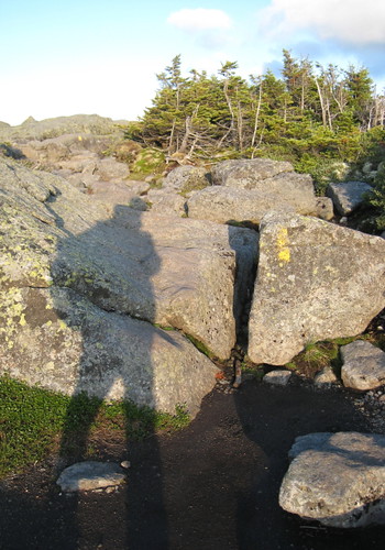
Cables leading down a section of the Gothics. Saddleback and Basin lie ahead.
As I made my way towards Saddleback, I came across a group of four or five big guys, with big packs to match. They warned me of the Saddleback cliffs to come, and the looks on their faces were the strongest recommendation for a light pack I can imagine. "That's the most scared I've been in my entire life," one of them admitted. I likewise warned them of the climb on the Gothics, but they seemed to know about the cables and were less worried. After summiting and descending from Saddleback, I credited them that the exposure was a bit nerve-wracking. It would have been far worse if I had been carrying more than perhaps eight pounds all-told.
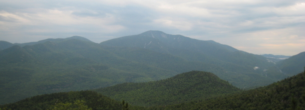
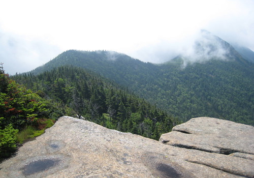
Looking back from Basin: Saddleback and the Gothics.
Basin had an impressive rock face that I had been admiring for several summits, but the rise to and fall from its peak were less dramatic than the last two had been. From it, I had a good vantage point of the last several peaks, as well as a view ahead to Haystack and Marcy.
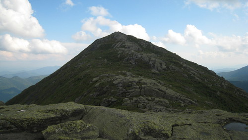
Little Haystack and the Marcy Summit
I knew I was behind schedule as I approached Haystack, even without a watch. The slow climbing, up and down among the inner peaks had cost me a great deal of time, and I decided to only go as far as Haystack's little brother. It saved me less than a mile, but I wanted all the time I could get, and knew I would have the tremendous view from Marcy soon enough. As it was, Little Haystack offered sights of its own. In close relief was Haystack, its alpine ground-cover a shade of golden-green, giving the mount its name. In the distance, Marcy, glowing from a break in the cloud cover.

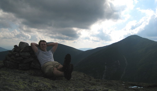
Laid back on Little Haystack. Marcy rises in the distance.
Dropping from the little peak to the trail, I made the climb towards Marcy, my final summit of the day. As has been written elsewhere, this is actually one of the easier climbs of the range. Crossing a marsh and heading above the treeline, the shadows were becoming longer, and I had the whole summit to myself. Green peaks, slivers of lake, a whirl of clouds, and an infinite sky. The view was spectacular, made more dramatic by the lighting of the descending sun. For my wife's peace of mind, I had packed my cellphone and now flipped it on. Not enough coverage to make a call, but it did find the time. 7:30.
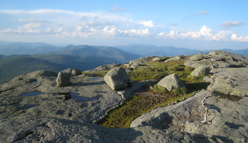
Mt. Marcy Summit.
Nightfall
As I left Marcy, I felt a second wind. From here on out, I would only lose altitude, and the trail would be relatively flat. But it was still 11 miles to my truck, so I started to jog. I wanted to make as much progress as I could before sunset, knowing that I would slow once it was dark. I exchanged my synthetic tee for a light fleece to keep me warm. I kept my light off as long as I could, making the most of the fading light. The dusk played its first tricks on me as I crossed a small stream. "Hey bear!" But it was only a tall stump.
A final picture of the day, as the shadows stretch and darkness takes over.
The last tangential glow of the sun gone, I flicked on my light. It was only a single LED, but I had done some navigation with it at night. As I hiked on, I began to lose steam and slowed somewhat. Between the dull light of my beam and building exhaustion, I started taking less care with my foot placement, banging them against rocks and plunging them into unseen soups. Despite this, I was still in good spirits, making slow but steady progress towards the finish.
I passed the Adirondack Mountain Club lodge and took a moment to assess my progress. I was about half way back to the truck and, as my still out of range phone told me, it was now 10:30. I would be late getting back to the vehicle and surely wouldn't be driving back to Burlington once I made it there.
Leaving the lodge, the long day and lack of sleep from the night before started to catch up with me. I started to hallucinate. As I walked, I saw a man and his dog, a kneeling woman, and innumerable "black flyers" flit across my field of vision. At one point I even came across another lodge, but this was no apparition. I had spent an hour walking on a short loop trail with markers seemingly identical to those for the path out. With nothing else to do but keep going, I found the correct path and carried on.
The End at Last!
I was awoken from my walking trance by a glowing field of phosphorescent blooms. I'd arrived at the appropriately named "Garden" trailhead and parking lot. My midnight-flowers were the reflective rings of traffic cones used to mark each spot. I seriously considered crashing behind a tree into my emergency bivy, but ultimately decided against it - remembering my lack of the required bear canister. Continuing on, I came to a paved road and cell phone reception. It was after 1:00. I called my now sleeping wife and let her know that all was well. I carried on, into the sleeping town of Keene Valley and on to my waiting pickup. Arriving there with a final push, I stumbled into the cab, reclined the driver's seat to its full extent of, perhaps, 45 degrees and fell fast asleep. The next morning I woke and traveled back to Burlington, still groggy but with an immense sense of satisfaction.
Full Gallery:
(The right and left arrow keys can be used to navigate within the gallery)
| |  |  |  |
 |  | |  |  |
 |  |  |  |  |
 |  |  |  | |
|  |


Great photos of your impressive "day hike". What kind of camera?
ReplyDeleteHi Peter,
ReplyDeleteI got back to you on the BPL forum, but I used a Canon SD800 IS. Like I said there, the mountains are more the cause of the good pictures than anything.
Best,
Devin
This comment has been removed by the author.
ReplyDeleteDevin,
ReplyDeleteDid you do this traverse solo? I am thinking about doing the loop over 2 or 3 days to take in the views. Thoughts?